
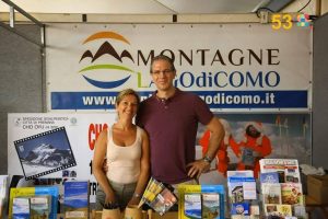
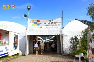
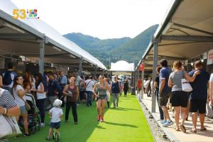
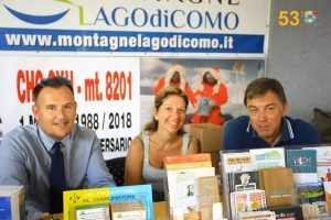
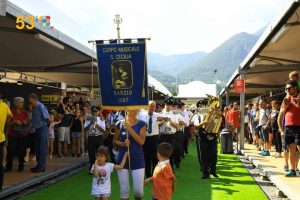
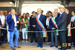
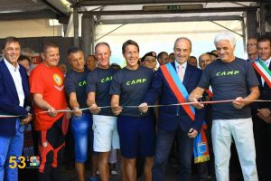
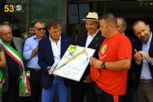
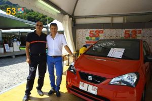
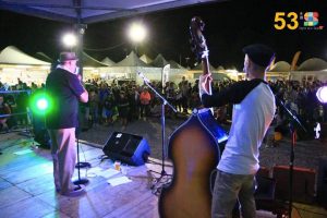
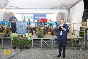
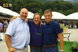
Anche nel 2018 Montagne del Lago di Como ha collaborato alla Sagra delle Sagre, la più importante manifestazione dell’estate valsassinese, gestendo dal 11 al 19 agosto 2018 lo stand n.1 di accoglienza turistica, in collaborazione con la Provincia di Lecco. Un’esperienza ricca e coinvolgente, che ci ha consentito di far conoscere il nostro territorio e le nostre imprese.
Qui sotto alcune immagini.
Clicca qui per conoscere l’elenco dei biglietti vincenti della Lotteria della Sagra delle Sagre 2018.

Grigne high crossing ( Traversata Alta ) is a difficult route , that has some equipped lines , with breathtaking landscapes on the mountains of Lake Como.
In this listing we propose the itinerary that connect Southern Grigna peak ( Grignetta ) and Northen Grigna peak ( Grignone ). You can reach Grignetta ( 2177 m ) starting from Resinelli plans ( 1270 m ) with different routes , such as Cresta Cermenati , Canalone Porta and Cresta Sinigaglia.
Once you reach Bocchetta Federazione , you go down through the homonymous canal that leads to Bocchetta di Giardino ( 2004 m ). So , you proceed , first through a scree and then through a path , crossing Conca di Campione until Buco di Grigna ( 1803 m ).
Leaving the path that goes to Rifugio Elisa , you have to climb helping you with the chains , until a grassy knoll ( Scudo Tremare , 1948 m ). Following this knoll , between little latches and amazing landscapes on Lake Como , you reach the base of a rock wall , that you have to climb using the chains. You continue until Bocchetta della Bassa ( 2144 m ), where you find Bivacco Merlini. From this point you follow the trail that go up from Pialeral and Rifugio Antonietta and you reach Northen Grigna peak ( 2410 m ) and Rifugio Brioschi.
For the return to Resinelli , you can do the same route until Bocchetta della Bassa and from here follow Grigne low crossing ( Traversata Bassa ).
Difficulty : EEA ( Expert Excursionist with equipment )
Travel time : Resinelli – Cresta Cermenati – High Crossing returning by the Low Crossing , about 5 hours
Photos by Alessandro Perego e Marzio Sambruni Vivisentieri
Cenghen Waterfall , called also Val Monastero Waterfall , is the highest of Grigne Group and it is situated in Abbadia Lariana.
It is crossed by the waters of the Zerbo creek , that go down fierce through a cleft in the rock and which shape a crystalline and fresh waterhole.
The waterfall is situated at about 600m of altitude and it is easily reachable with a short route that , starting from Abbadia or Linzanico , goes through Val Monastero.
The itinerary is recommended to everyone because it is composed by laneds and confortable paths. This route is suitable in all the seasons , even if is particularly recommended during the summer time , and it could be combined with a trekking on Wanderer’s Trail.
Photos by Anna Falsitta
The Northen Grigna peak is the highest of the Grigne group with its 2410 m. It is an arrival point of many itineraries and it offers a wonderful landscape on Alps and Prealps. In this listing we suggest the slope along the itinerary Cainallo , Bogani , Via della Ganda , Rifugio Broschi ( trail 25 ).
The start is at Alpe Cainallo ( about 1300 m ), where you can park your car ( paying ). In this first line of the path you have to pay attention to the trail signs because the first line is in common with the other trails , that leads to Mount Croce and Pilastro ( n. 23 ) and to Rifugio Bietti ( hut , n. 24 ). You have to follow always the trail sign Bogani – Brioschi n. 25 and , between beech and larch trees woods , rocky zones and some peaks and troughs , you reach the Moncodeno Alp ( 1680 m ) , the crossroad to the Glacier , and then Rifugio Bogani ( hut ) in about 1 hour and 30 minutes.
Once you have passed Bogani hut and the crossroad to Riva hut , you find a Virgin Mary in bronze on a rock and you enter in the Grignone screes. The path has a stone surface and it alternates uphill stretch with small turns. The last 100 m lines are the more challenging , very steep on smooth rocks. You can find some chains that could help you to climb without sliding, then you finally reach near Rifugio Brioschi ( hut ) and observation deck.
In the peak you can find a little Church in glass that is dedicated to St. Mary of the paths , the peak cross and a sort of cylinder that presents the names of the tops and of the locations that you can admire , its high and the direction in wich you have to see.
Travel time : about 3 hours
Difficulty : E ( Excursionist )
We suggest to do this itinerary in summer , after melting snow.
There is also a variant of this route that foresees to reach the peak walking through the Crest of Piancaformia ( trail 19 ). The crossroad is situated near Rifugio Bogani. The climb has a travel time of 3 hours and 30 , and an higher difficulty level EE ( Expert Excursionist ).
Discover also the route from Balisio Hill to the Northen Grigna peak.
Photos by Gabriele Invernizzi and Valeria Viglienghi
The Northen Grigna peak is the highest of the Grigne group with its 2410 m. It is an arrival point of many itineraries and it offers a wonderful landscape on Alps and Prealps. In this listing we suggest the slope along the itinerary Balisio , Sacro Cuore Church , Pialeral , Brioschi following the trails 31 and then 33.
You can start from Balisio in Ballabio ( 720 m ), or you can reach by car the chapel of Sacro Cuore ( about 820 m ), along a an about 3 km dirt road. Alternatively you can go to Pialeral from Pasturo. Nearby are the Grassi and Lunghi and Brunino. You reach Alpe Cova and then the Antonietta al Pialeral Refuge (1365 m), between landscapes on Pizzo Tre Signori , Grignetta , Grignone and Zuccone Campelli. You walk in a wood , following a steep path between rocks. You go on between grasslands , following the maximum inclination line until you see a rock that serves as a crossroad for the summer route and the winter route ( red inscription ).
Summer route: Travel time 3 hours and 30, Difficulty E ( Excursionist )
If you decide to proceed with the summer route , the trail has since the beginning a sustained inclination. The path develops just below the crest that with steep rising gradients leads to Bocchetta of Releccio ( 2263 m ), after a last steep bound , you reach some steps that lead to the observation deck of Rifugio Brioschi ( 2410 m ).
In the peak you can find a little Church in glass that is dedicated to St. Mary of the paths , the peak cross and a sort of cylinder that presents the names of the tops and of the locations that you can admire , its high and the direction in wich you have to see.
Winter route: Travel time 4 hours and 30 Difficulty A ( Alpinist ) – Easy itinerary for alpinists with different levels of difficulty according to the conditions of enneigement.
The winter choise , instead , goes on from Baite dei Comolli and Bivacco Riva Girani ( 1830 m ), through a very steep rap , called wailing wall , until the Grignone north – east crest. This is the more challenging part of the itinerary because of the slope that reach 45 grades and of the eventual accumulation of snow that you can find ; for this reason it is necessary to carry with you the proper equipment ( crampons and pick ).
Discover also the route from Cainallo to the Northen Grigna peak.
Photos by Ermes Malvisi, Giacomo Perrucchini and from the sites www.ilpiaceredellamontagna.it and www.adelinatiziano.blogspot.com
Villa Monastero hosts a series of exhibitions not to be missed, which are held in different periods:
For more information, visit www.villamonastero.eu
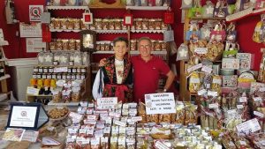
The Barzio’s Library organize for SAturday, September the 2nd, the “3° Caviadini Exhibition”, that will take place at the Manzoni Palace, in Via Alessandro Manzoni, 12, form 10.00 a.m.
The purpose of this event is to make known the tipical cookies of the Valsassina through this appointments:
During the day it is possible to assist, in the afternoon , to the event “Saltimbarzio“.
The manifestation will close with a Nomadi Tribute by the group “Aironi Neri”.
In the playbill other informations.
Tradizionale festa della Madonna Addolorata, organizzata da tutte Associazioni di Pagnona, in collaborazione con il Consiglio Pastorale della Parrocchia di Sant’Andrea e con il Patrocinio del Comune di Pagnona.
Numerosi sono gli appuntamenti religiosi e non che caratterizzano questa manifestazione, tra cui la consueta fiaccolata organizzata dalla Polisportiva Pagnona nella serata di sabato 19 settembre.
Per tutti gli appuntamenti verrà al più presto caricata la locandina.
Sunday, September 15th, the 13th edition of the Tour of Montecchi will take place in Colico. It’s an 8km non-competitive walk that develops along a naturalistic route of great beauty.
In addition there will also be the 9th edition of the Adriano Tosarini memorial. It is a non-competitive 2 km walk for kids we finish at age 13.
During the day it will be possible to follow the route with a free pace walk, open to all.
In the poster all the information and contacts.