
Mount Legnone ( 2609 m ) is the highest peak of the Orobie Lecchesi. It is a very popular mountain that offers itineraries suitable to everyone in areas of average altitude , while the routes toward the peak are suggested to experienced hikers.
It is possible to climb on the Mount Legnone peak starting from Rifugio Griera ( mountain hut , 1700 m ). You go on following the military road that starts in Pagnona and you travel all the Mount Legnone south crest. It intercepts , in some points , the military road until the Bocchetta Alta of Legnone ( 2395 m ). From here you proceed through the crest until you reach the peak. Along the route there aren’t trail signs , but the paths are clear and the direction is intuitive.
Once you reach the peak you can see the peak cross and you can also admire a breathtaking panorama on Valtellina , on Lake Como and on its mountains.
Difficulty : EE ( Expert Excursionist )
Travel time : about 4 hours round trip
Discover also the itinerary from Roccoli Lorla to Mount Legnone.
Photos by Pietro Buttera and Stefano Tagliaferri
Mount Legnone ( 2609 m ) is the highest peak of the Orobie Lecchesi. It is a very popular mountain that offers itineraries suitable to everyone in areas of average altitude , while the routes toward the peak are suggested to experienced hikers.
The most embarked path that goes to Legnone peak starts to Roccoli Lorla in Valvarrone ( 1460 m ) situated at the foot of Mount Legnoncino. From here , you go into the wood where you can find some alpine pastures until the end of the vegetation : walking through the trail you can see suggestive larches and rhododendrons.
From this point you hide until the bivouac Cà de legn and from here the route becomes heavier because of its slope , and in some points you have to climb on the rock ; the peak trail is entirely equipped with chains and steps.
Once you reach the peak you can see the peak cross and you can also admire a breathtaking panorama on Valtellina , on Lake Como and on its mountains.
Difficulty : EE ( Expert Excursionist )
Travel time : about 3 hours and 30 round trip
Discover also the itinerary from Rifugio Griera to Mount Legnone.
Photos by Marzio Sambruni Vivisentieri and Paola Piva
It is worth to discover the uncontaminated beauty of Val Biandino and of Lake Sasso , on the foot of Pizzo Tre Signori , in all seasons : in summer and spring for the luxuriant flowerings and the greens pastures , in winter for the white mantle of the snow.
You can reach climbing the valley entrance from Introbio , or by jeep using the transport service organised by the mountain huts. Our itinerary starts from Rifugio Tavecchia ( mountain hut , 1420 m ). From here you have to follow the laned that goes to Madonna della Neve Sanctuary , symbol of the valley , where the skyline is starting to open up. You have to take the path that goes to the left side of the valley and that climbs erratically until Rifugio Santa Rita ( mountain hut , about 2000 m ), from its terrace there is a great view on Pizzo Tre Signori , Valvarrone and Val Biandino. You go on following the trail signs and you reach , crossing a path that go down along the crest , Lake Sasso ( 1922 m ), situated in a magneficent frame of rocks under Pizzo Tre Signori , it is considered one of the most beautiful lakes of the northen orobico side.
From the lake you can cross again all Val Biandino , walking through green lawns , until you return in about 1 hour to Rifugio Tavecchia.
Difficulty : E ( Excursionist )
Travel time : Rifugio Tavecchia – Rifugio Santa Rita 1 hour and 30 ; S. Rita – Lake Sasso about 1 hour , return to Rifugio Tavecchia about 1 hours
Photos by Gabriele Invernizzi con Laura
Discover the itinerary Tour of the Lakes of Bitto.
Pizzo Tre Signori ( 2554 m ) is a very popular massive rocky peak between hiking passionate. It is the hightest peak of the western sector of the Orobies , after Mount Legnone , and it offers an extended panorama in all directions.
It is called Pizzo Tre Signori ( three men ) because in the past the borders of Grignoni , Venetian Republic and Duchy of Milan met on its peak ; actually there are the province of Sondrio , Bergamo and Lecco.
Our itinerary goes along Val Biandino , starting from Rifugio Santa Rita ( mountain hut , about 2000 m ). From here you follow the trail that bypasses the first northern reliefs of the crest that divide high Valvarrone from high Val Biandino. During the route , some lines are equipped with chains. Going on you can see that the path moves on the grassy southern slope , reaching Bocchetta di Piazzocco ( 2249 m ). This is the point of connection of different itineraries that go on the peak , from Valvarrone and Val Gerola ; so , from this point the route is common to all.
You have to follow the trail signs , the path is characterised wrinkled plates : in the beginning you climb between rubbles but then the route become rockier. The last lines are equipped with a metallic rope that goes until the peak. Once you reach the peak you can admire an amazing panorama on the Alps , accompanied by the Pizzo peak cross.
There are different itineraries to go back , indicated at Bocchetta di Piazzocco : from Via del Caminetto , from Bocchetta di Foppagrande , from Rifugio Grassi or retracing the path toward Rifugio Santa Rita.
Difficulty : EE ( Expert Excursionist )
Travel time : about 2 hours the climb Pizzo Tre Signori
Photos by Gabriele Invernizzi con Laura
Comunichiamo che la cabinovia da Barzio per i Piani di Bobbio resterà aperta tutti i sabati e le domeniche di settembre e ottobre, dal 1 settembre al 28 ottobre 2018 compresi.
Per orari e prezzi consulta il sito www.pianidibobbio.com.
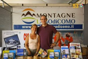
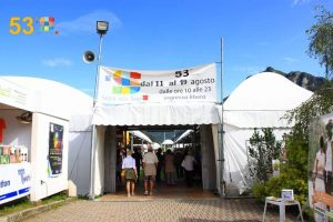
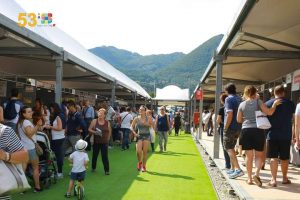
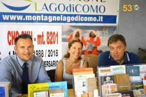
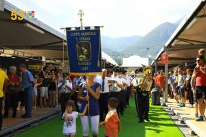
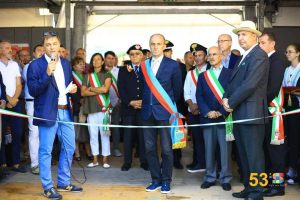
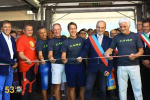
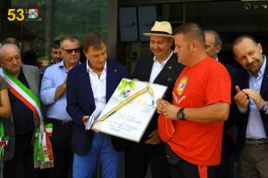
Anche nel 2018 Montagne del Lago di Como ha collaborato alla Sagra delle Sagre, la più importante manifestazione dell’estate valsassinese, gestendo dal 11 al 19 agosto 2018 lo stand n.1 di accoglienza turistica, in collaborazione con la Provincia di Lecco. Un’esperienza ricca e coinvolgente, che ci ha consentito di far conoscere il nostro territorio e le nostre imprese.
Qui sotto alcune immagini.
Clicca qui per conoscere l’elenco dei biglietti vincenti della Lotteria della Sagra delle Sagre 2018.

Grigne high crossing ( Traversata Alta ) is a difficult route , that has some equipped lines , with breathtaking landscapes on the mountains of Lake Como.
In this listing we propose the itinerary that connect Southern Grigna peak ( Grignetta ) and Northen Grigna peak ( Grignone ). You can reach Grignetta ( 2177 m ) starting from Resinelli plans ( 1270 m ) with different routes , such as Cresta Cermenati , Canalone Porta and Cresta Sinigaglia.
Once you reach Bocchetta Federazione , you go down through the homonymous canal that leads to Bocchetta di Giardino ( 2004 m ). So , you proceed , first through a scree and then through a path , crossing Conca di Campione until Buco di Grigna ( 1803 m ).
Leaving the path that goes to Rifugio Elisa , you have to climb helping you with the chains , until a grassy knoll ( Scudo Tremare , 1948 m ). Following this knoll , between little latches and amazing landscapes on Lake Como , you reach the base of a rock wall , that you have to climb using the chains. You continue until Bocchetta della Bassa ( 2144 m ), where you find Bivacco Merlini. From this point you follow the trail that go up from Pialeral and Rifugio Antonietta and you reach Northen Grigna peak ( 2410 m ) and Rifugio Brioschi.
For the return to Resinelli , you can do the same route until Bocchetta della Bassa and from here follow Grigne low crossing ( Traversata Bassa ).
Difficulty : EEA ( Expert Excursionist with equipment )
Travel time : Resinelli – Cresta Cermenati – High Crossing returning by the Low Crossing , about 5 hours
Photos by Alessandro Perego e Marzio Sambruni Vivisentieri
Cenghen Waterfall , called also Val Monastero Waterfall , is the highest of Grigne Group and it is situated in Abbadia Lariana.
It is crossed by the waters of the Zerbo creek , that go down fierce through a cleft in the rock and which shape a crystalline and fresh waterhole.
The waterfall is situated at about 600m of altitude and it is easily reachable with a short route that , starting from Abbadia or Linzanico , goes through Val Monastero.
The itinerary is recommended to everyone because it is composed by laneds and confortable paths. This route is suitable in all the seasons , even if is particularly recommended during the summer time , and it could be combined with a trekking on Wanderer’s Trail.
Photos by Anna Falsitta
The Northen Grigna peak is the highest of the Grigne group with its 2410 m. It is an arrival point of many itineraries and it offers a wonderful landscape on Alps and Prealps. In this listing we suggest the slope along the itinerary Cainallo , Bogani , Via della Ganda , Rifugio Broschi ( trail 25 ).
The start is at Alpe Cainallo ( about 1300 m ), where you can park your car ( paying ). In this first line of the path you have to pay attention to the trail signs because the first line is in common with the other trails , that leads to Mount Croce and Pilastro ( n. 23 ) and to Rifugio Bietti ( hut , n. 24 ). You have to follow always the trail sign Bogani – Brioschi n. 25 and , between beech and larch trees woods , rocky zones and some peaks and troughs , you reach the Moncodeno Alp ( 1680 m ) , the crossroad to the Glacier , and then Rifugio Bogani ( hut ) in about 1 hour and 30 minutes.
Once you have passed Bogani hut and the crossroad to Riva hut , you find a Virgin Mary in bronze on a rock and you enter in the Grignone screes. The path has a stone surface and it alternates uphill stretch with small turns. The last 100 m lines are the more challenging , very steep on smooth rocks. You can find some chains that could help you to climb without sliding, then you finally reach near Rifugio Brioschi ( hut ) and observation deck.
In the peak you can find a little Church in glass that is dedicated to St. Mary of the paths , the peak cross and a sort of cylinder that presents the names of the tops and of the locations that you can admire , its high and the direction in wich you have to see.
Travel time : about 3 hours
Difficulty : E ( Excursionist )
We suggest to do this itinerary in summer , after melting snow.
There is also a variant of this route that foresees to reach the peak walking through the Crest of Piancaformia ( trail 19 ). The crossroad is situated near Rifugio Bogani. The climb has a travel time of 3 hours and 30 , and an higher difficulty level EE ( Expert Excursionist ).
Discover also the route from Balisio Hill to the Northen Grigna peak.
Photos by Gabriele Invernizzi and Valeria Viglienghi